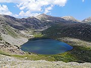
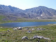
Hunter–Fryingpan Wilderness
Protected area in Colorado, USThe Hunter–Fryingpan Wilderness is a U.S. Wilderness Area located in White River National Forest east of Aspen, Colorado. The 82,026-acre (331.95 km2) wilderness established in 1978 includes the headwaters of Hunter Creek and the Fryingpan River plus many peaks of the Williams Mountains. It borders on the Mount Massive Wilderness to the east, separated only by the continental divide. There are 50 miles (80 km) of trails in the wilderness area.
Read article
Top Questions
AI generatedMore questions
Nearby Places

Linkins Lake

Independence Lake (Colorado)
Lake in Pitkin County, Colorado

Lost Man Lake
Lake in Pitkin County, Colorado

Mount Oklahoma
Mountain in the state of Colorado
Williams Mountains
Mountain range in Pitkin County, Colorado, United States
Bill Williams Peak
Mountain summit in Pitkin County, Colorado, United States

Twining Peak
Mountain in the American state of Colorado

Geissler Mountain
Mountain in Colorado, United States


